Buildings' Footprints Map
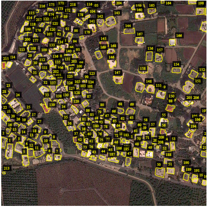
The first comprehensive Lebanese Building Footprints map was autonomously generated using Deep Learning Models that were developed and tested at the Lebanese National Remote Sensing Center - CNRS. We trained fully convolutional ‘Encoder-Decoder’ like Neural Networks on GEOEYE-1 high resolution satellite images (50 cm/pixel) from the Year 2013 for semantic segmentation of buildings' footprint.
When you ZOOM IN, the dots on the map refer to the centroids of each building at a specific geographical location. The map can be accessed via the following link.
The following research manuscripts are focused on urban features extraction from aerial images:
Dr Ali J. Ghandour
Associate Researcher
My research interests include earth observation, smart city transportation, urban features detection from high resolution aerial imagery and geospatial deep learning.