I am an associate researcher at the Lebanese National Center for Remote Sensing - National Council for Scientific Research (CNRS), where I have established the GEOspatial Artificial Intelligence (GEOAI) group. I earned a Ph.D. in Computer Communication in 2013 and was with Toyota Motor North America, InfoTech Labs at Mountain View, USA, before joining CNRS in 2015, where I also acted as the coordinator of the Lebanese National Innovation Transfer Network.
I have over 40 publications with unique research focus on AI-assisted mapping spanning various applications, urban analytics, transportation, waterbodies monitoring and crop-yield estimation. I develop tools integrating deep learning techniques to automate the process of urban features extraction and collect crowd-sourcing data from various sources. Evidence gained from my models and data analysis allows for a robust humanitarian response and provides policymakers and key stakeholders with insights to design tailored regulations and safety countermeasures for urban social good. In the past, I made research contributions to Intelligent Transportation Systems (ITS), vehicular cognitive networks and IEEE P1609 standard Working Group.
- Remote Sensing
- Earth Observation
- Smart City
- Transportation
- Geospatial Deep Learning
Research
Buildings' Footprints Map
The first comprehensive Lebanese Building Footprints autonomously generated using Deep Learning.
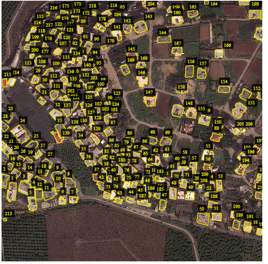
Buildings Type Classification
Buildings Classification using Very High Resolution Satellite Imagery
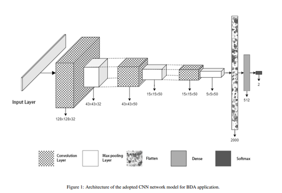
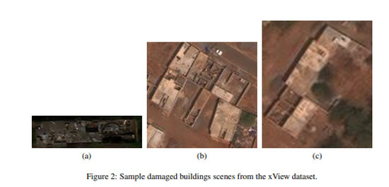
Buildings Damage Assessment
Buildings Classification using Very High Resolution Satellite Imagery
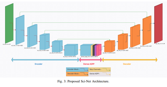
Sci-Net
Sci-Net: a Scale Invariant Model for Building Detection from Aerial Images
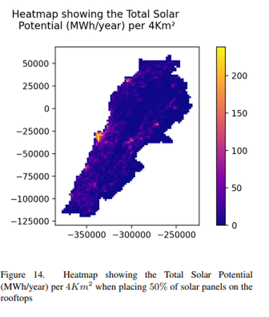
Solar Potential Map for Lebanon
Solar Potential Assessment using Multi-Class Buildings Segmentation from Aerial Images
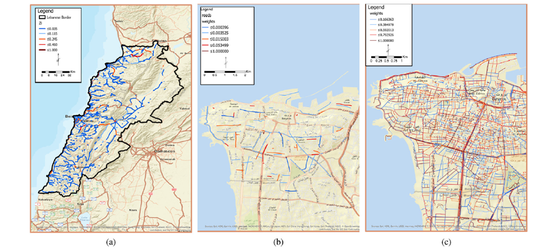
LRCP
Lebanese Road Crashes Platform
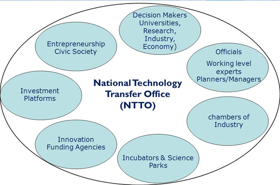
National Technology Transfer Network
Enhance national innovation system capacity
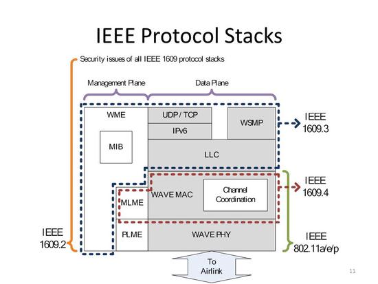
WAVE1609 Tool
Modeling and Simulation of WAVE 1609.4-based Multi-channel VANETs